 |
| Intensa nebulosidade sobre a região do RJ, MG e ES. NASA, 6 de janeiro de 2012. |
 |
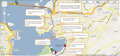
| Imagem interpretada pela NASA mostra os pontos de maior intensidade de chuvas. NASA, 30 de dezembro de 2011. |
Torrential rain inundated southeastern Brazil in early January 2012, causing severe damage in multiple states. The floods forced thousands from their homes, damaged roads and homes, and broke through a levee in northern Rio de Janeiro State, according to news reports.
This image shows regional rainfall, as observed by the Tropical Rainfall Measuring Mission (TRMM), from December 30, 2011, to January 6, 2012. Rainfall amounts are color coded, with the lowest amounts in blue and the highest amounts in red and purple. A band of heavy precipitation extends roughly northwest-southeast. Some of the heaviest rainfall occurs north of Rio de Janeiro, capital city of the state of the same name.
On January 9, 2012, The Rio Times reported that flooding affected the states of Minas Gerais, Rio de Janeiro, and Espirito Santo. So far, damage was apparently most severe in Minas Gerais.
References
- Duailibe, M. (2012, January 8). Heavy rain keeps Rio State flooded. The Rio Times. Accessed January 9, 2012.
- Duailibe, M. (2012, January 9). Brazil reacts to multi-state floods. The Rio Times. Accessed January 9, 2012.
NASA image courtesy the Tropical Rainfall Measuring Mission (TRMM). Caption by Michon Scott.
- Instrument: TRMM


Nenhum comentário:
Postar um comentário
Contribua. Deixe aqui a sua crítica, comentário ou complementação ao conteúdo da mensagem postada no Blog do Axel Grael. Obrigado.